This blog usually explains how utility bills are calculated. Today is the exception: Lumenware Labs, the team behind Платіжка, has released a second app. It is called Terrella, and it is a globe you can put in your pocket.
Spin it with a finger, zoom in, tap any country, river or mountain range and read about it. Drag the timeline and the borders redraw themselves: empires appear, spread and vanish in front of you.
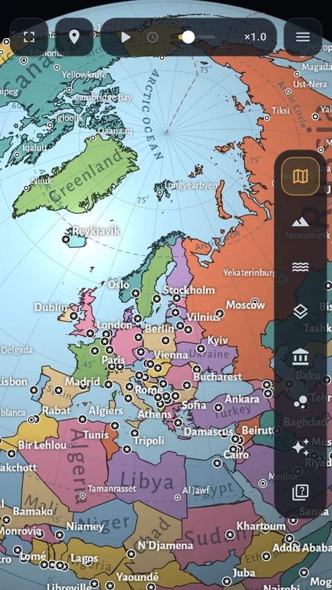
The political globe 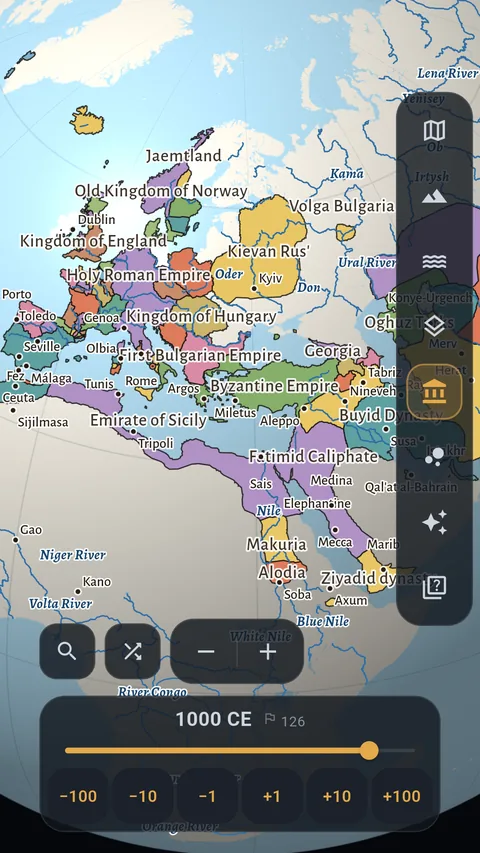
The world in 1000 CE 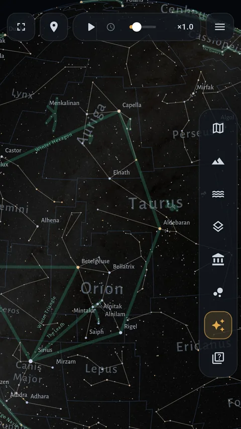
The star globe
A 3D globe of the Earth, not a satellite photo
There is no shortage of maps on a phone, but nearly all of them are for getting somewhere: a road, an address, a route. Terrella is for looking at the world. It is drawn like a printed desk globe: relief in layer tints by height, a 15° graticule, and names that run along countries, seas and mountain ranges instead of sitting on top of them as tags.
Every map is stored on the phone. A connection is needed only to open the article about a place you tapped.
Seven globes, from a world map with countries to the solar system
- Political — a world map with countries, regions and cities.
- Topographic — mountains, plains, plateaus.
- Hydrographic — rivers, lakes, seas and the ocean floor with its trenches and ridges.
- Combined — the three above, laid over one another.
- Historical — the borders of states from 6000 BCE to the present.
- Solar system — real orbits, the planets and their moons.
- Star globe — the celestial sphere and its constellations.
A historical world map with a timeline
The historical globe is a world map with a timeline. Drag the slider and the map answers, and you watch the map of empires change over time: states rise and break apart, cities appear and the abandoned ones go dark. Cities also change their names with the eras, as they really did.
The borders are not drawn by eye. They come from the Cliopatria historical atlas, a scholarly reconstruction of the borders of the world's states. Tap any state to read what is known about it.
A star map with all 88 constellations
New in version 1.1. All 88 constellations and about 5,000 of the brightest stars. Named stars have cards: distance in light years, colour, class. Asterisms are shown too — familiar shapes such as the Big Dipper that are not official constellations. And the sky can be seen from the inside, as a panorama around you.
Place cards and a geography quiz
Countries, cities, rivers, seas, mountains, historical states, planets and stars all open an information card with the Wikipedia article. When there is no article in your language, automatic translation from another one can be switched on.
The geography and history quiz is built from the same data the globe draws: capitals, borders, flags, straits, which came first. The options are new every time, so the only thing you can memorise is the fact, not where the right button was.
What is free and what is in Pro
Free: all seven globes, search, the cards and the quiz. The free historical globe covers 1700 to the present.
Terrella Pro adds depth:
- deeper zoom with regions and more detailed labels;
- the whole timeline, back to 6000 BCE;
- descending to the surfaces of planets and moons;
- the advanced quiz level;
- a live wallpaper: any of three globes on your home screen.
Pro comes as a subscription or as a one-time lifetime purchase.
Where the data comes from: Natural Earth, Wikipedia, Wikidata and the Cliopatria historical atlas; NASA imagery for the satellite view. The app speaks seven languages: English, German, French, Spanish, Portuguese, Ukrainian and Russian.
Платіжка is not going anywhere: it stays free, and this blog will keep explaining tariffs. We simply have two apps now.